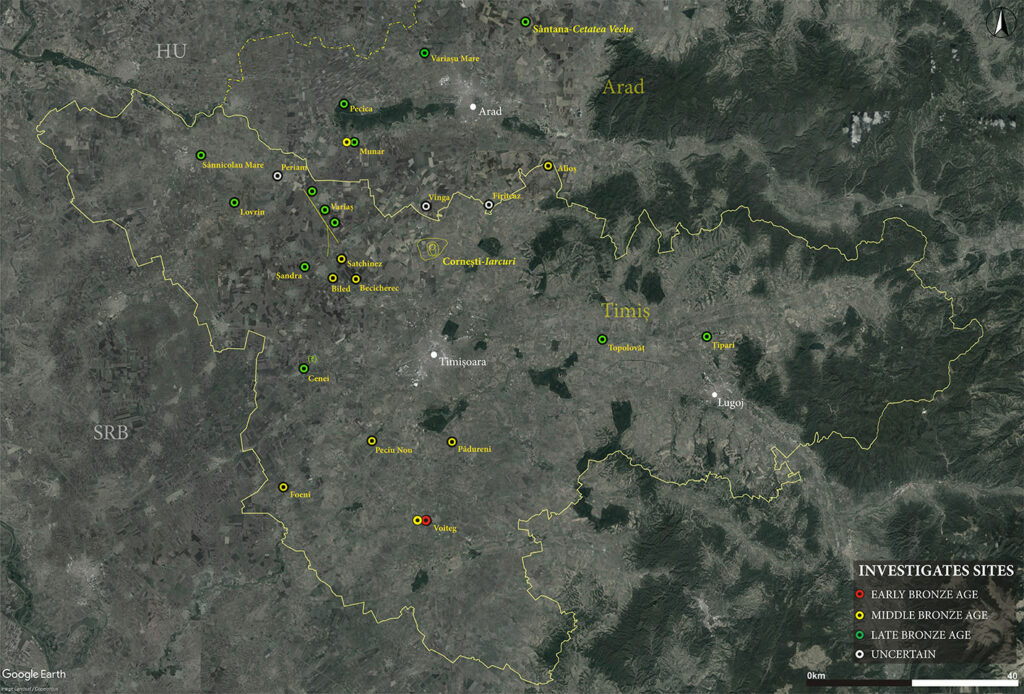
Between the confluence of the Tisza and Mureș rivers, a small area southeast of the Pannonian Plain was home to the largest fortifications of the European Bronze Age.
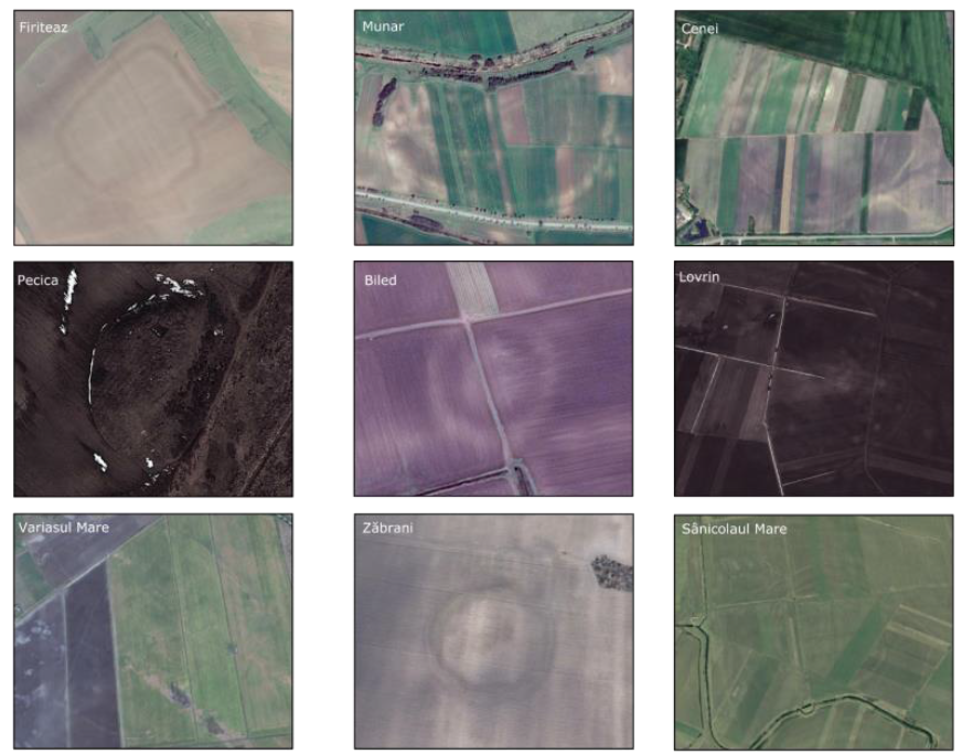
More than 30 large earthworks dating back to the Bronze Age are known today in southwestern Romania as the archaeological remains are still well individualized on satellite images. Many of them were discovered by archaeology enthusiasts who scrutinized satellite images, inspected the sites in the field, and even published research papers based on their results.
Because of the lack of systematic field surveys, the majority of enlisted fortifications lacked digital cartographic material. Only a few had the chance to be surveyed in order to create accurate digital elevation models.
Prior to the existence of this project, no systematic surveys or site mapping were undertaken, with a few exceptions.
Taking all of this into account, the motivation for this project was related to the enormous scientific potential of these sites and the certainty that, based on our experience in archaeology and geoscience, we could advance our understanding of these Bronze Age fortifications located in southwestern Romania. In addition, we proposed an interdisciplinary methodology for faster data acquisition. Another aspect of our motivation was the lack of documentation related to these archaeological sites, which are constantly being destroyed due to intensive agricultural work.